Dam Failure Threat Sparks Evacuations
The remnants of former Hurricane Polo unleashed devastating rainfall across the U.S. Southwest on Tuesday, flooding roadways, prompting mass evacuations in New Mexico, and triggering emergency rescues as communities already saturated by recent storms struggled with rising waters.
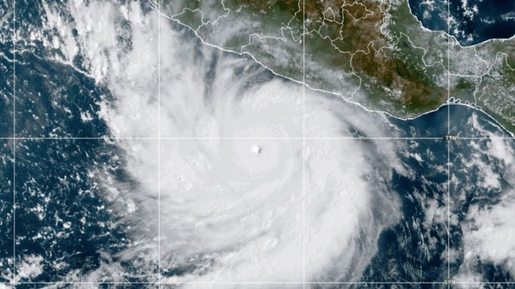
Polo struck Mexico's Baja California Sur state Tuesday morning as a major hurricane with sustained winds of 110 mph before weakening as it moved northeast across the Gulf of California. By evening, the storm had degraded to tropical storm status, but its moisture continued battering the Southwest with torrential rain.
Dam Failure Threat Sparks Evacuations
In south central New Mexico, concerns about the McLeod Dam, also known as the Garfield Dam, prompted urgent evacuation orders for residents in Rincon, Salem, and Garfield along the Rio Grande. Authorities later expanded evacuations to include Hatch, a community of 1,500 to 1,600 people known for its prized green chile crops, and the town of Placitas farther north.
The dam experienced a small piping failure, though emergency crews deployed pumps to alleviate pressure on the structure. By September 30, evacuation orders were lifted for Salem, Hatch, Garfield, and Placitas, though Rincon residents remained displaced while officials continued monitoring the situation.
Multiple Water Rescues Across Region
Emergency responders conducted numerous rescues as flash flooding transformed normally dry desert washes into raging torrents. West of Phoenix, a helicopter crew from Arizona Fire and Medical Services lifted a person from atop their overturned vehicle in floodwaters. North of the city, another driver escaped safely after their truck was swept away in a wash, according to Maricopa County sheriff's officials.
In Utah's Zion National Park, helicopter crews rescued three people trapped in Heaps Canyon after flash flooding struck. The park's slot canyons are particularly vulnerable to rapid flooding. During a 2015 flash flood incident in Keyhole Canyon, the North Fork of the Virgin River surged from 55 cubic feet per second to 2,630 cubic feet per second in just 15 minutes, killing seven people. On Tuesday, the East Fork of the Virgin River raged with muddy floodwater, carrying a shipping container downstream.
Near Orderville, Utah, resident Sabrina Dubay rushed home after her partner warned her away.
"The river came in and swept around the entirety of our house,"Dubay said. Neighbors dug trenches as water rose around the structure.
"It was coming in through our front doors,"she recalled. The flooding swept away a camper, snowmobile trailer, and other items from their property.
Extraordinary Pacific Hurricane Season
Polo represents the latest storm in what has become an extraordinarily active 2026 eastern Pacific hurricane season, now ranking as the fifth most intense Pacific hurricane season on record with an Accumulated Cyclone Energy value of 244.1, trailing only the 2018, 1992, 2015, and 1990 seasons. As of early September, the Northeast Pacific had already generated 15 named storms and six hurricanes, well above historical norms for that point in the season.
This exceptional Pacific activity contrasts sharply with the Atlantic basin, which has remained remarkably quiet. Through September 11, the 2026 Atlantic season had produced just five named storms and no hurricanes, surpassing the latest date for a first Atlantic hurricane in the satellite era.
The stark disparity between ocean basins reflects the influence of a powerful El Niño event. The 2026 El Niño has intensified beyond the threshold for a "super El Niño," with ocean waters warming at least 2 degrees Celsius above average, and forecasts suggest it may become the strongest El Niño in modern records.
"Pacific storm activity has been above average this year. That is consistent with El Niño years,"National Weather Service meteorologist Carter Greulich in Albuquerque explained.
Ground Already Saturated
The flooding threat was compounded by an unusually wet September across the Southwest. Storms had rolled through parts of the region overnight Monday, saturating the ground and amplifying Tuesday's runoff.
"Runoff is likely going to start much quicker and lead to those flooding impacts quicker,"Greulich said. He urged residents to avoid flooded roadways and stay out of arroyos, especially in urban areas where water accumulates rapidly.
The region's rocky desert terrain typically receives less than 10 inches of rain annually, with minimal vegetation to absorb moisture, making flash flooding a persistent danger. The New Mexico Department of Transportation reported flooded roads and debris scattered across highways throughout the state. The Bureau of Land Management in Arizona documented significant flooding and damage to access roads in a national conservation area and sand dunes recreation area in the southeastern part of the state.
Residents Assess Damage in Mexico
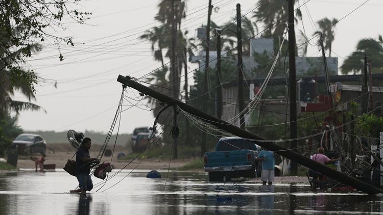
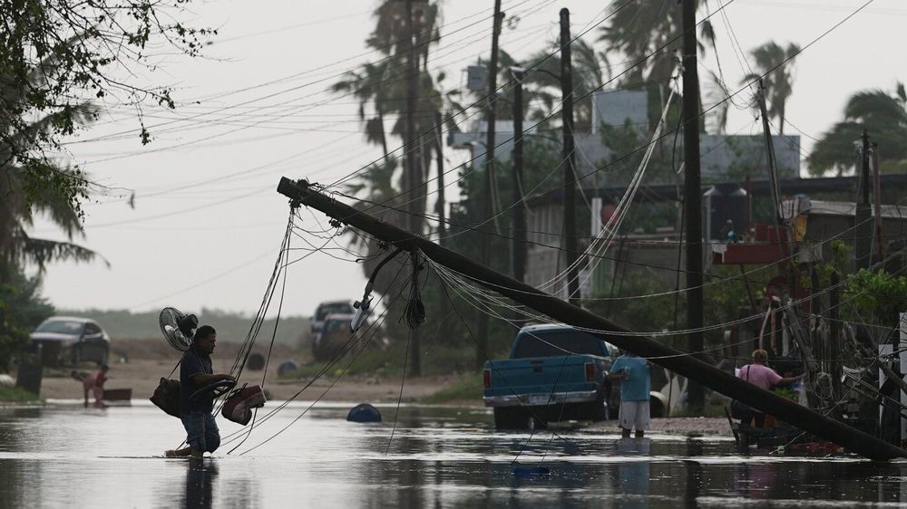
Back in Baja California Sur, residents of the small fishing town of Puerto San Carlos waded through ankle-high water among downed trees after Polo passed. Though the hurricane had threatened catastrophic damage, many found their community largely intact.
Shopkeeper Elbia María Bachomo, 40, surveyed furniture strewn through her home. She and her three children had gathered their belongings quickly and fled to a shelter Monday as water flooded into their residence. Her husband was fishing for sardines when Polo struck and barely escaped alive.
"I thought, 'Oh no, what are we going to come back to? We will be left with nothing.' But we were lucky,"Bachomo said.
Hundreds of people sheltered in Baja California Sur were expected to return home. The region has faced devastating hurricanes before. In 2014, Hurricane Odile became the most destructive hurricane on the Baja California peninsula in recorded history, making landfall near Cabo San Carlos as a major hurricane and causing approximately $1 billion in damage while leaving more than 90 percent of Baja California Sur without electricity.
Additional Storms Developing
As the Southwest continued dealing with Polo's aftermath, forecasters tracked additional threats. The National Hurricane Center reported Tropical Storm Rachel moving parallel to Mexico's coast approximately 300 miles west-southwest of Lazaro Cardenas with maximum sustained winds of 70 mph. The storm was expected to strengthen into a hurricane soon while moving northwest at 13 mph.
In the central Pacific Ocean, Hurricane Nolo slowed Tuesday but continued threatening dangerous conditions for parts of Papahanaumokuakea Marine National Monument after drenching portions of the Big Island over the weekend.
Meanwhile, the flood risk was forecast to shift toward the central United States later in the week, with heavy rain expected to hit Texas and Oklahoma beginning Tuesday night. Parts of Colorado, Kansas, Nebraska, and Iowa remained under flood watches, with flooding possible through at least Thursday.